


 GENERATION GENIUS


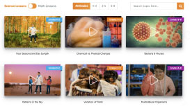
Science & Math
$/yr
A weather map shows air masses and weather fronts to predict changes. For example, it uses blue lines and triangles for cold fronts.
View Lesson on Air Masses & Weather Fronts
If you are on a school computer or network, ask your tech person to whitelist these URLs:
*.wistia.com, fast.wistia.com, fast.wistia.net, embed-fastly.wistia.com, embed-cloudfront.wistia.com, embedwistia-a.akamaihd.net
Sometimes a simple refresh solves this issue. If you need further help, contact us.
Learning about weather maps helps us understand how experts predict the weather and why getting it right is important. Experts use special tools and computers to look at things like air pressure, wind, and temperature to make these maps. This helps us get ready for bad weather, decide what to wear, or plan things like parties outside.
Weather maps aren’t just for TV weather people. They are important for figuring out big storms like tornadoes and hurricanes. Information from weather stations and satellites makes weather forecasts better. This is important to keep people safe and protect homes. Knowing how to use weather maps is useful for everyday life.


In this lesson, we learn that:


Skip, I will use a 3 day free trial
Enjoy your free 14 days trial

