
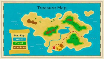


A map is a model of the Earth’s surface that uses colors, shapes and symbols to tell us about landforms, weather or the boundaries of countries.
To better understand how maps work…
LET’S BREAK IT DOWN!
There are many different landforms on Earth.
In different places on Earth you can find mountains, forests, lakes, rivers, islands and more. To know where all these landforms are, scientists create and share maps.
Maps use shapes, colors and symbols.
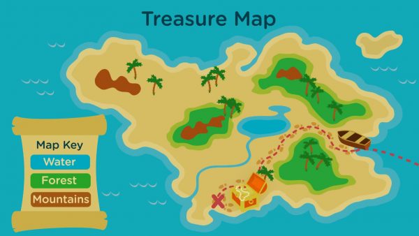
Maps use colors to show different types of features like land, water and forests. Maps also use symbols to show us where things are located – like a treasure!
Physical maps can show us landforms.
Physical maps show us where to find mountains, forests, rivers, lakes and many more landforms. If you are going on a hike, you will want to look at a physical map.
Another type of map is called a political map.
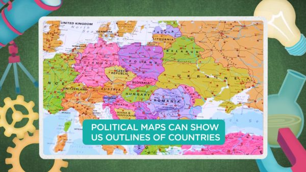
Political maps show us the boundaries of countries, states, provinces or cities. A very common political map shows the United States and the borders of all 50 states.
Weather maps give us useful information too.
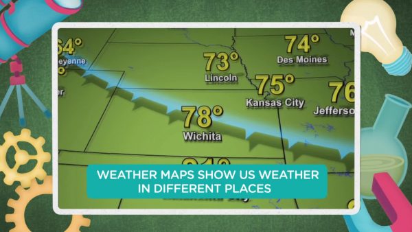
Weather maps show us weather in certain places. They can help us know what to wear. They can also tell us that a storm is coming to help us stay safe.


 Select a Google Form


 GENERATION GENIUS