


 GENERATION GENIUS


Science & Math
$/yr
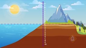
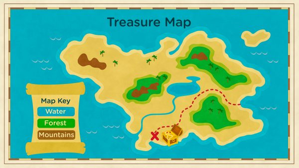
A physical map shows landforms and natural features of the Earth's surface. For example, it represents mountains and rivers for hiking.
View Lesson on Maps of Landforms
If you are on a school computer or network, ask your tech person to whitelist these URLs:
*.wistia.com, fast.wistia.com, fast.wistia.net, embed-fastly.wistia.com, embed-cloudfront.wistia.com, embedwistia-a.akamaihd.net
Sometimes a simple refresh solves this issue. If you need further help, contact us.
Learning about physical maps is important for a lot of jobs. These maps are key for people working in fields like geography and environmental science. Physical maps show details about the earth, like rivers, mountains, and woods. This information is important for studying how humans affect nature, predicting the weather, planning trips, and managing natural resources.
Physical maps are useful for outdoor fun, adventure trips, jobs focused on protecting natural places, and studying rocks and land. They help in figuring out where water and forests are, making sure outdoor adventures are safe. Physical maps are valuable for making decisions in the real world.

In this lesson, we learn that:


Skip, I will use a 3 day free trial
Enjoy your free 14 days trial

