Reading Material
1%
It was processed successfully!
WHAT IS A MAP?
A map is a model of the Earth’s surface that uses colors, shapes and symbols to tell us about landforms, weather or the boundaries of countries.
To better understand how maps work…
WHAT IS A MAP?.
A map is a model of the Earth’s surface that uses colors, shapes and symbols to tell us about landforms, weather or the boundaries of countries.
To better understand how maps work…
LET’S BREAK IT DOWN!
There are many different landforms on Earth.
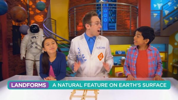
In different places on Earth you can find mountains, forests, lakes, rivers, islands and more. To know where all these landforms are, scientists create and share maps.
There are many different landforms on Earth. In different places on Earth you can find mountains, forests, lakes, rivers, islands and more. To know where all these landforms are, scientists create and share maps.
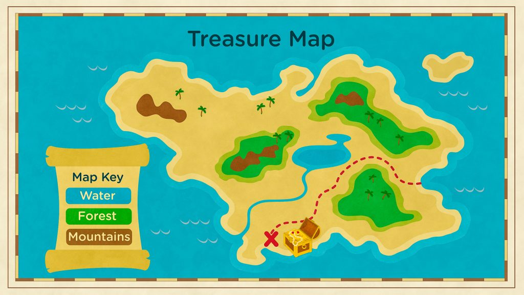
Maps use shapes, colors and symbols.
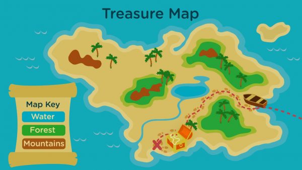
Maps use colors to show different types of features like land, water and forests. Maps also use symbols to show us where things are located – like a treasure!
Maps use shapes, colors and symbols. Maps use colors to show different types of features like land, water and forests. Maps also use symbols to show us where things are located – like a treasure!
Physical maps can show us landforms.
Physical maps show us where to find mountains, forests, rivers, lakes and many more landforms. If you are going on a hike, you will want to look at a physical map.
Physical maps can show us landforms. Physical maps show us where to find mountains, forests, rivers, lakes and many more landforms. If you are going on a hike, you will want to look at a physical map.
Another type of map is called a political map.
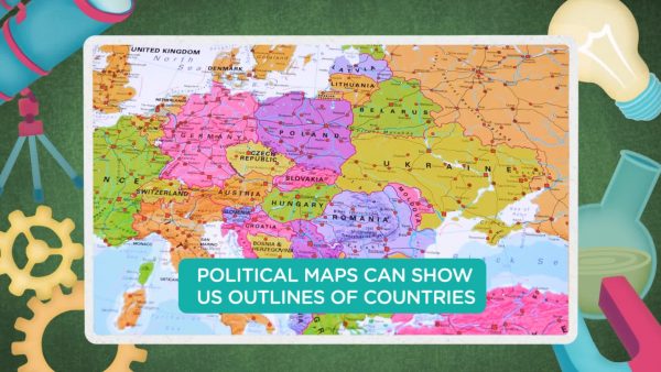
Political maps show us the boundaries of countries, states, provinces or cities. A very common political map shows the United States and the borders of all 50 states.
Another type of map is called a political map. Political maps show us the boundaries of countries, states, provinces or cities. A very common political map shows the United States and the borders of all 50 states.
Weather maps give us useful information too.
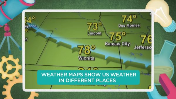
Weather maps show us weather in certain places. They can help us know what to wear. They can also tell us that a storm is coming to help us stay safe.
Weather maps give us useful information too. Weather maps show us weather in certain places. They can help us know what to wear. They can also tell us that a storm is coming to help us stay safe.
MAPS VOCABULARY
Map
A model of the Earth’s surface that uses colors, shapes and symbols that can tell us about landforms, weather or boundaries of countries.
Landform
A natural feature of the Earth’s surface, such as a mountain.
Physical Map
A map showing landforms and natural features of the Earth’s surface.
Political Map
A map showing boundaries of countries, states, provinces or cities.
Weather Map
A map that lets us know about temperature or rain in certain places.
Mountains
Areas of land that rise up sharply compared to their surroundings.
QUESTIONS ABOUT MAPS
What are some types of maps?
Political maps are one type of map. They show boundaries of countries, states or cities. Physical maps show landforms. Weather maps show us weather in different places. A globe is a round map of the Earth.
How is a physical map different than a political map?
A physical map shows natural features of the land, while a political map shows the boundaries of countries, states or cities.
What are some different landforms?
Mountains and hills are tall and rise above the surrounding land. Coasts are where the land meets the ocean. Rivers may flow through the land. An island is a body of land surrounded by water.
How can maps help us navigate?
Maps show landforms and natural features on the Earth’s surface to guide travelers. We can use maps of roads to tell us which road to take.
What does a globe show?
A globe is a 3D map in the shape of a ball. It shows us a map of the whole world. It can show the world’s landforms, countries or both at the same time!
How do scientists use maps to share information?
Scientists can use weather maps to tell people what kind of weather to expect near them. Maps can also show them were to find certain landforms so they can study the kinds of plants and animals that live there.


 GENERATION GENIUS


x
Choose Your Free Trial Period
Get 30 Days Free
By inviting 4 other teachers to try it too.
Skip, I will use a 3 day free trial
Thank You!
Enjoy your free 30 days trial